Louisville Unearthed: The mysterious Chicken Steps of Clifton

One of my favorite oddities in Louisville is hidden away in the Clifton neighborhood. And for 10 years, I lived blocks away from this interesting local landmark without really knowing where it was.
A couple of years ago, after hearing the term “Chicken Steps” repeatedly in the neighborhood, I set out to figure out what and where they were. Knowing a general vicinity, I parked my car at the CVS on lower Brownsboro Road and started off in search of these mysterious steps.
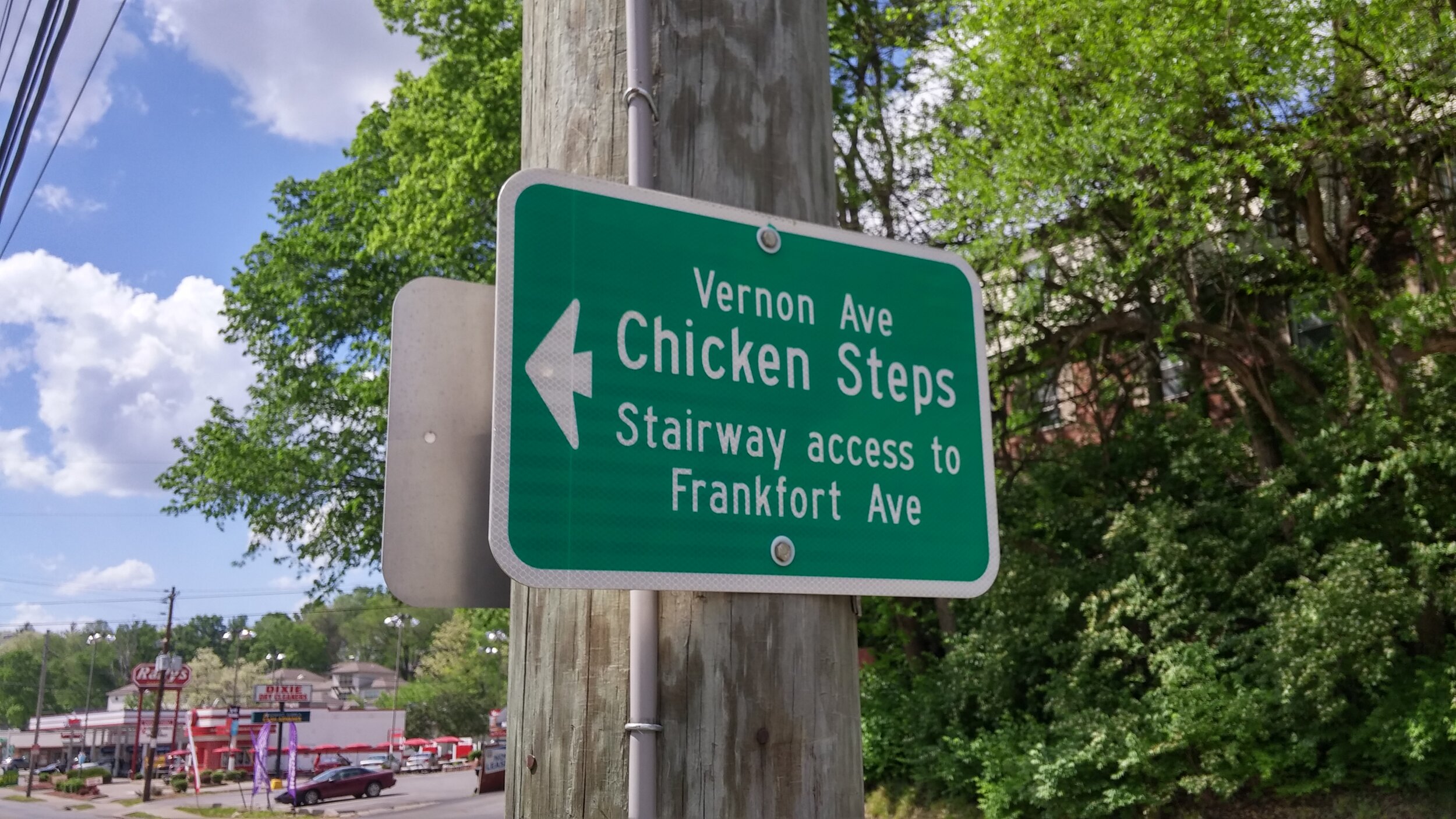
I had walked maybe 20 steps when I noticed for the first time a green sign with an arrow and, simply, “Vernon Ave. Chicken Steps, Stairway Access to Frankfort Ave.”
Hmmm, I thought. Maybe that’s it.
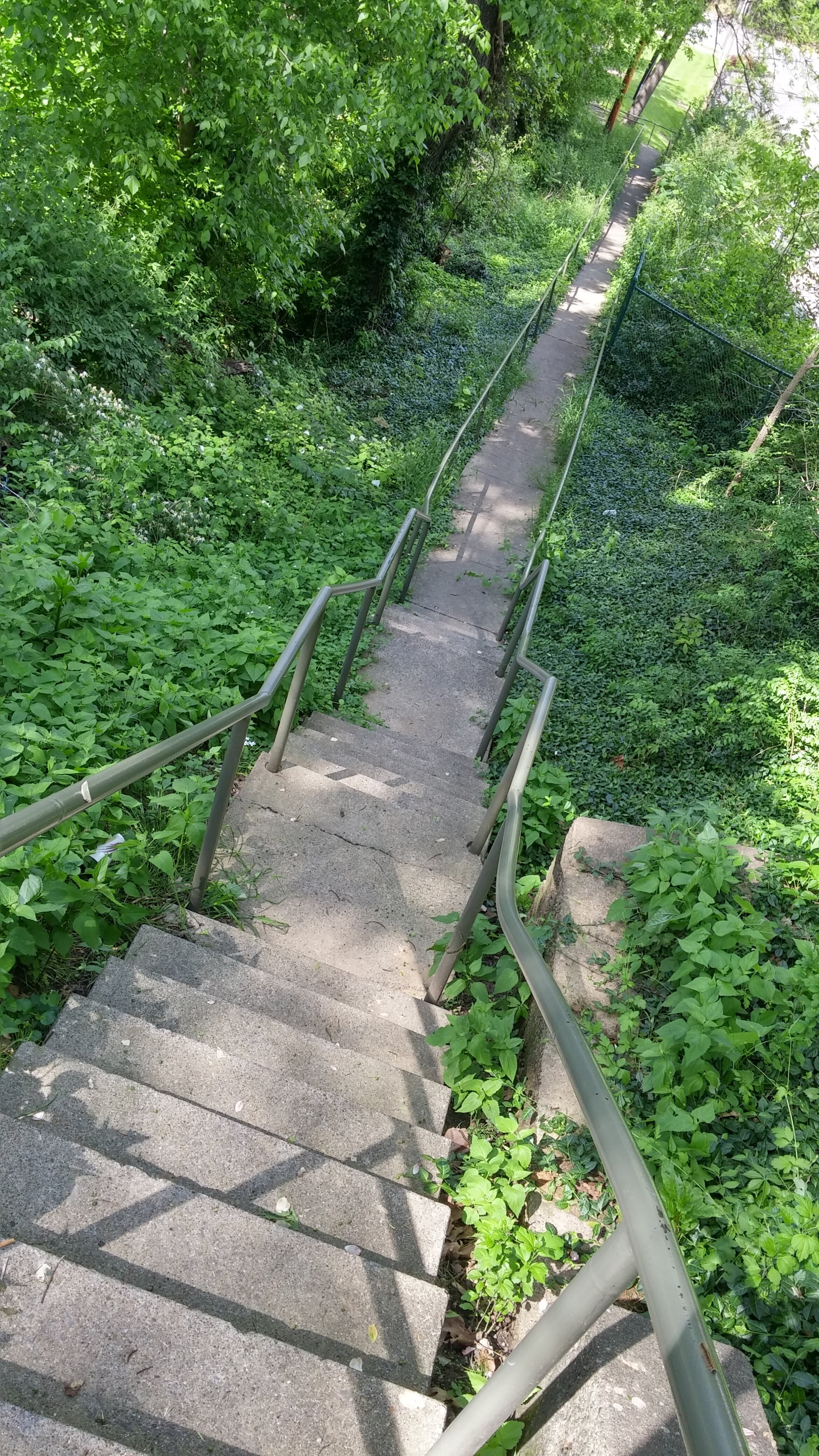
Sure, I felt like an idiot, but I was also glad my quest wasn’t going to be an arduous one. Sure enough, I turned to follow the arrow and the legendary Chicken Steps quickly came into view. (To be fair, climbing those steps was a little on the arduous side.)
Essentially, the Chicken Steps are just a simple pedestrian shortcut, a connector between Frankfort Avenue and Brownsboro, at the bottom end behind the 24-hour car wash and CVS and the top end at the foot of Vernon Avenue.
But they’re apparently more than just a handy staircase connecting the two busy streets. The spot on Vernon where the steps begin their descent is the one-time location of Fort Elstner, one of 11 Union forts constructed to defend Louisville during the Civil War. In fact, a giant artillery gun apparently was mounted on the spot that is now a home at 188 Vernon Avenue, designed to ward against Confederate troops and situated on top of the cliff that gives the neighborhood its name.

A 1964 map showing the location of Fort Elstner, just above “Brownsborough Turnpike Road.” Note that at the time, Frankfort Avenue was “Louisville and Lexington Turnpike Road.” (Photo courtesy of Wikimedia Commons.)
The fort was completed in 1864, so it probably wasn’t utilized much, although many troops were stationed there at one point.
The next question, of course, is, “Why are they called the Chicken Steps?” The fun part about that is no one is really sure – that’s just what they’ve always been called. Some believe the steps, which number 35 including the midway landing, may have gotten their name because chickens used to roost on an earlier wooden version. (The current concrete steps with metal rails were constructed by the city in 1972.)
But when were the original steps built? Were they attached in any way to Fort Elstner? Probably not, but who can be sure? Most likely, whoever owned the land unceremoniously decided to build the steps simply for neighborhood access.
One theory is that the original wood version was built sometime in the late 1800s after Clifton transformed from fort to neighborhood. Residents there raised chickens, which would head down the slope to graze, then would have no way to get back to the top. As this theory goes, locals likely built the original steps as a way to retrieve their lost chickens.
A 2003 report from the Louisville Metro Planning and Design Services notes, “The name ‘Chicken Steps’ likely came about from the days when area residents raised chickens, some of which chose this hilltop site upon which to roost.” Otherwise, all we really have are theories, which is kind of fun.
Hey, regardless where the name originates, it beats climbing down that hill.
Every Friday, Louisville Unearthed will bring you an unusual fact, historical nugget, place, person, etc., that you may not know about our city.